RAVAM REQUEST A BRIEFING →
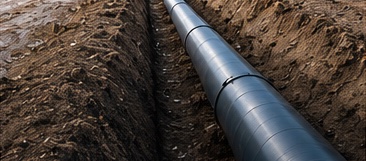
RAVAM UAV surveying an underground pipeline corridor
PIPELINE INTELLIGENCE

From Underground Pipeline Corridor to Integrity Intelligence.

Locate buried infrastructure. Screen for anomalies. Prioritize verification. Build a continuously improving operational picture.

BURIED / UNDERGROUND

Find what is hidden.

ABOVE-GROUND PIPELINES

Inspect what you can see.

RIGHT-OF-WAY MONITORING

Protect what matters.

See What Cannot Be Seen From the Surface.

Multi-sensor approach for complete pipeline corridor intelligence.

Satellite data

SATELLITE

Context & planning

UAV survey

UAV SURVEY

Aerial data collection

Magnetometry

MAGNETOMETRY

Detect pipeline-related signals

GPR

GPR (OPTIONAL)

Subsurface confirmation

GIS model

GIS & 3D MODEL

Geospatial integration

Digital twin

DIGITAL TWIN

Living asset model

AI intelligence

AI INTELLIGENCE

Risk analysis & monitoring

From Signal to
Engineering Decision.

A clear and defensible workflow.

LOCATEFind the pipeline corridor
SCREENDetect anomalies
PRIORITIZEFocus on what matters
VERIFYField verification
ASSESSEngineering decision
⚠ Anomaly ≠ Confirmed Defect

Magnetic and geophysical data identify areas of interest. Confirmation is performed through appropriate verification methods and accepted integrity practices.

“Better information.
Better decisions.
A safer tomorrow.”

Our 5-Phase Pipeline Intelligence Framework.

Each phase delivers value. Together, they create a complete solution.

SCALABLE. MODULAR. REAL-WORLD RESULTS.
01

UNDERGROUND CORRIDOR ASSESSMENT

Locate → Survey → Screen → Prioritize → Verify

02

DIGITAL TWIN

Turn survey and verification data into a living geospatial asset.

03

ENTERPRISE INTEGRATION

Connect GIS, CAD, asset data and agreed operator systems.

04

CONTINUOUS MONITORING

Autonomous UAVs + field sensors + RAVAM NEST™ where appropriate.

05

PREDICTIVE INTELLIGENCE

Trend analysis, risk scoring and maintenance prioritization after sufficient data accumulates.

Built Around Real Pipeline Corridors.

Challenging terrain. Vegetation. Infrastructure. Real-world conditions.

Real-world pipeline conditions

Applications

From national networks to local distribution.

NATURAL GASTransmission and distribution networks
OILCrude and gathering pipelines
PRODUCTRefined-product pipelines
WATERWater transmission infrastructure
DISTRICT HEATINGThermal distribution networks
INDUSTRIALPlant and process pipelines
RIGHT-OF-WAYCorridor and encroachment monitoring
REGULATORYInspection records and reporting support

One Corridor. One Growing Intelligence Record.

Every survey, verification, sensor reading and engineering finding becomes part of the pipeline's digital history, supporting better decisions over time.

REQUEST INFORMATION →