
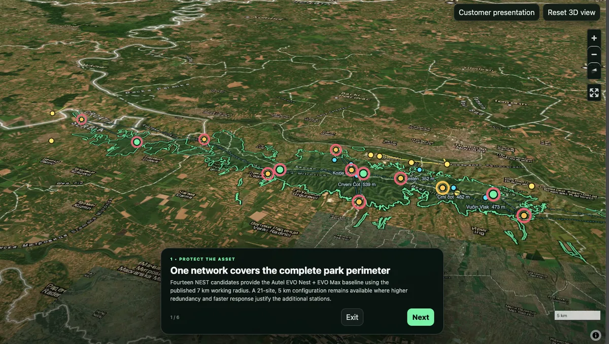
01 · PROTECT THE ASSET
One network covers the complete park perimeter.
Use the 14-site, 7 km planning baseline to model park-wide coverage, then compare a denser 21-site alternative where response time or redundancy justify it.
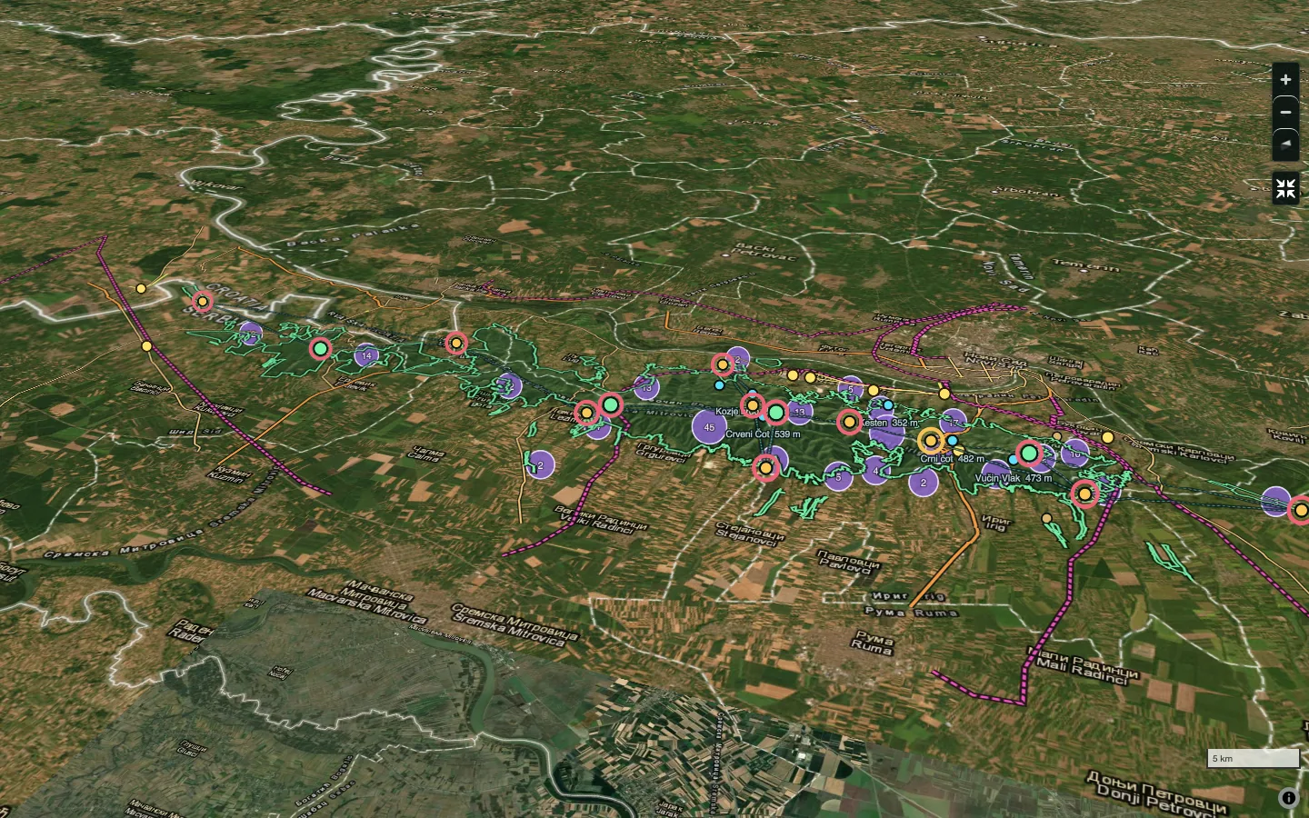
RAVAM models terrain, conservation constraints, access, infrastructure, communications and recurring service opportunities before hardware deployment—so the field network is engineered around the real environment.
The network concept combines the park boundary, candidate NEST locations, terrain, visitor and heritage context, roads, power corridors, settlements and communications logic. The same environment can support executive review, ranger planning, emergency response and technical engineering.
Use the 14-site, 7 km planning baseline to model park-wide coverage, then compare a denser 21-site alternative where response time or redundancy justify it.
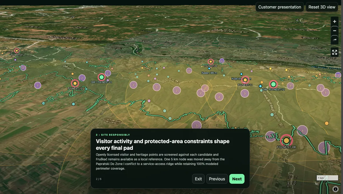
Screen candidate locations against protected-zone context, visitor and heritage points, terrain and access before any field commitment.
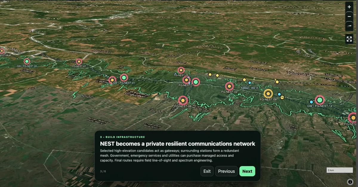
Use selected high-elevation nodes as gateway candidates and connect surrounding stations through a redundant mesh, subject to field LOS and spectrum engineering.
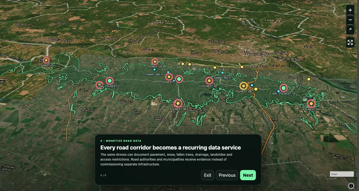
The same fleet can document access, pavement, snow, fallen trees, drainage, landslides and other corridor conditions for separately contracted public-infrastructure services.
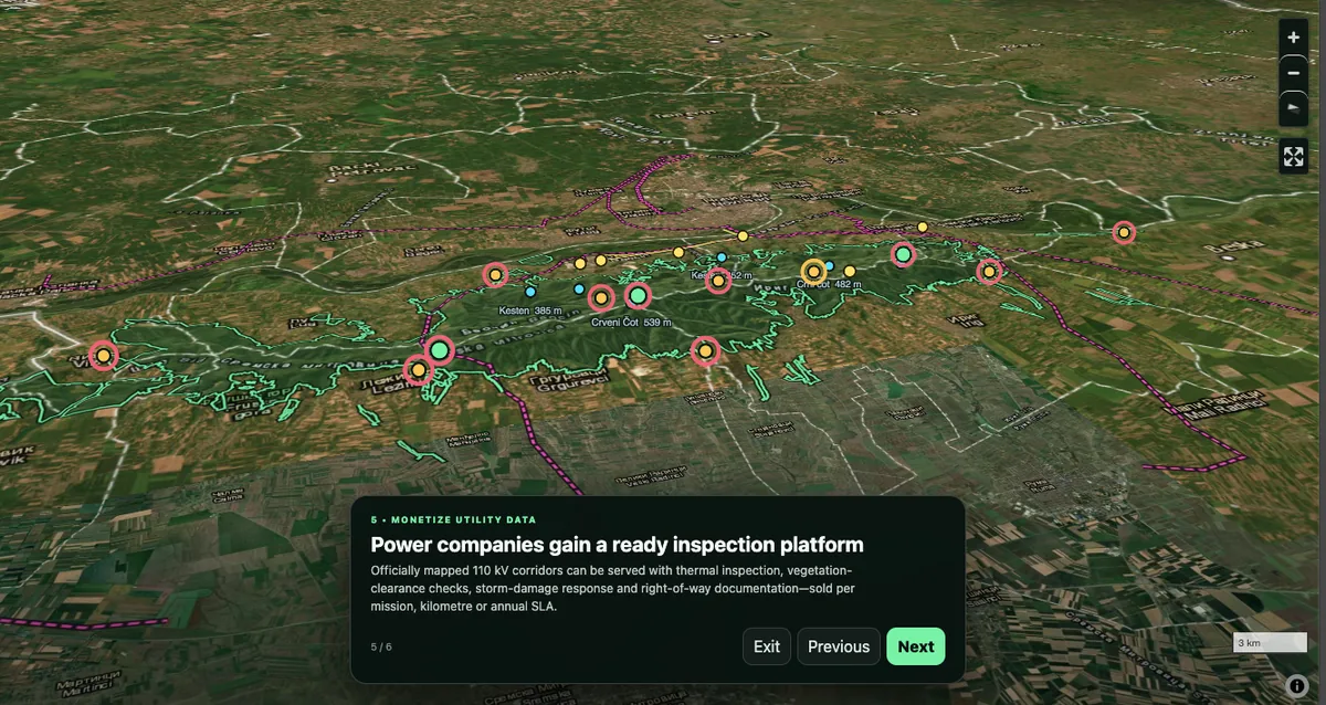
Mapped utility corridors can support mission-configured thermal inspection, vegetation-clearance checks, storm-damage response and right-of-way documentation.
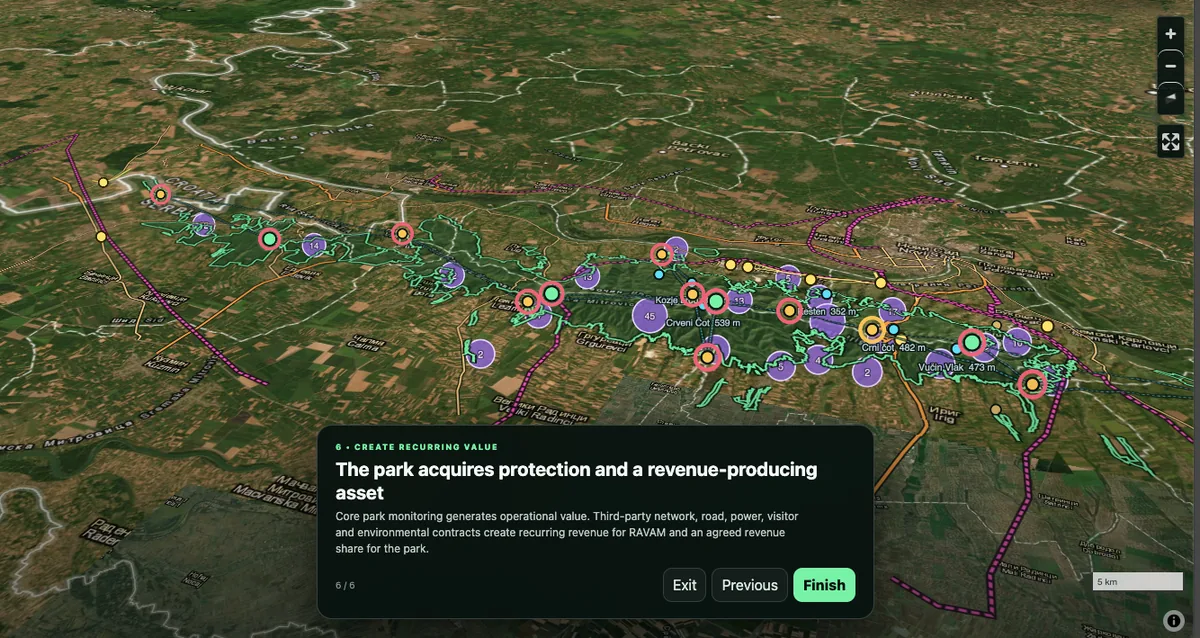
Core monitoring creates direct operational value; the same field network can support separately contracted road, utility, visitor, environmental and emergency-response services.
RAVAM can model a small number of road-accessible emergency staging points around the park for fire-response equipment and approved suppression materials. These locations would sit alongside the monitoring network, not replace existing fire-service infrastructure.
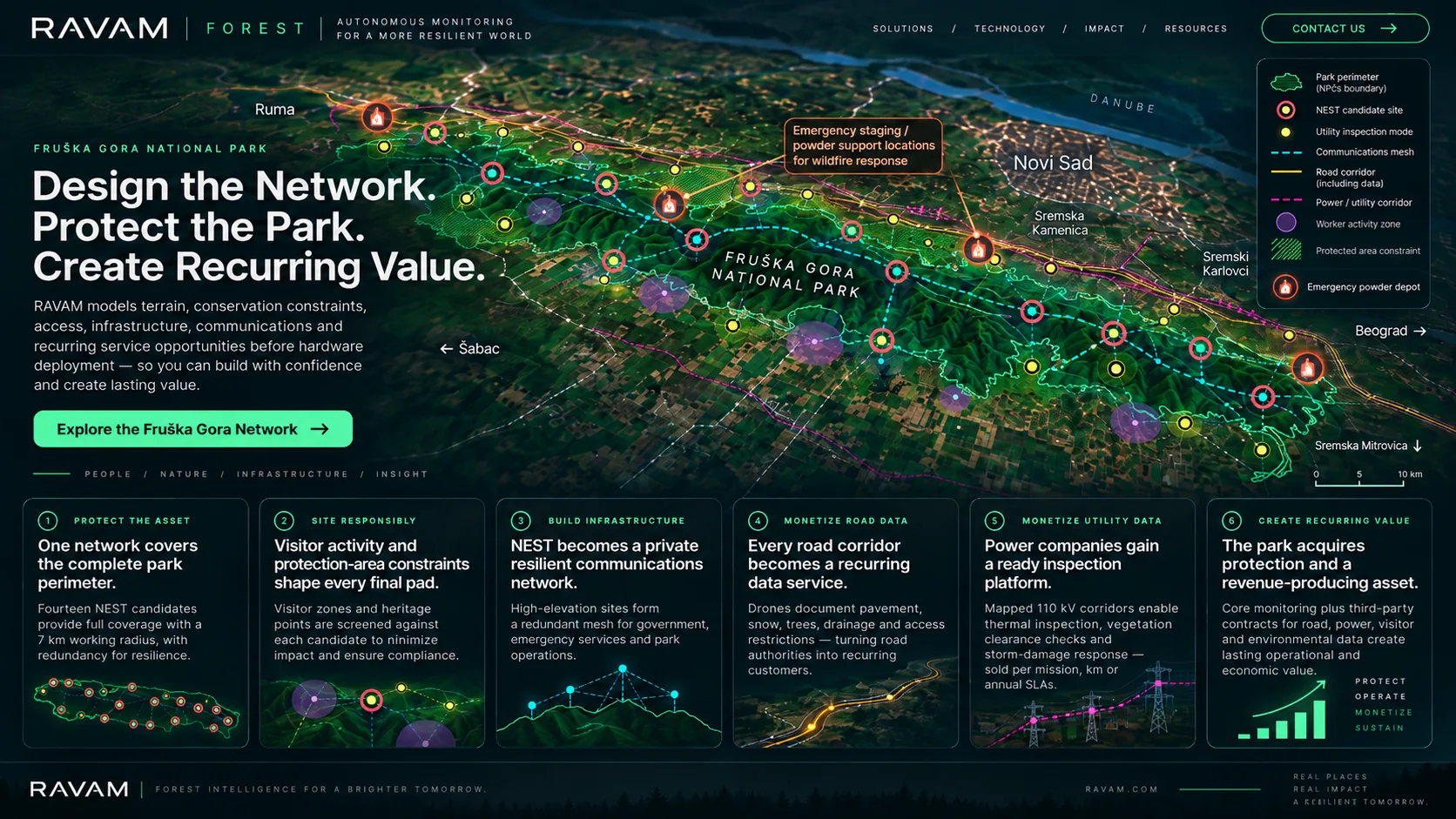
The map is the deployment-intelligence layer around a wider RAVAM system: field nodes, aircraft, mission control and the AI intelligence platform.
Review the deployment model, candidate-station logic, infrastructure layers and recurring-service opportunities, then talk to RAVAM about adapting the architecture to your territory.