

Autonomous Intelligence for Agriculture.
A precision agriculture system connecting aerial monitoring, soil and weather information, field sensors, AI analysis and targeted treatment into one operational workflow.
Move from treating the whole field the same way to understanding what each area actually needs.
RAVAM AGRO™ connects observation, agronomic context and action. The objective is not simply to fly a drone over a field, but to create a repeatable intelligence cycle that helps identify change, prioritize intervention and measure the result.

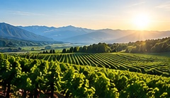
From Field to Decision.
Stationary or mobile deployments can combine RAVAM field infrastructure, autonomous aircraft, sensors and agricultural intelligence tools.

RAVAM AIR™
RGB, multispectral, thermal and treatment missions across fields, vineyards and orchards.

RAVAM NEST™
Stationary or mobile field infrastructure for charging, connectivity, weather, edge computing and operations.

RAVAM MOBILE™
Pickup-based mobile spraying and field-operations configuration supporting deployment across multiple agricultural locations without requiring a permanent station at every parcel.

RAVAM AI PLATFORM™
Field maps, data fusion, crop analytics, change detection, agronomic models and recommendations.
Agricultural Intelligence.
The exact data model depends on crop, geography, season and management objectives.
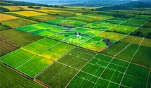
Crop Health
Vegetation vigor, stress patterns, emergence, canopy change and anomaly detection.
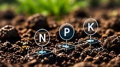
Soil & Nutrients
Soil-test inputs, pH, nutrient balance, field variability and fertilizer planning.

Water & Weather
Moisture, precipitation, temperature, wind and localized environmental conditions.

Disease & Pest Risk
Visual and multispectral indicators that can help prioritize field inspection and intervention.

Yield & Field Performance
Historical comparison, management zones and season-to-season performance intelligence.
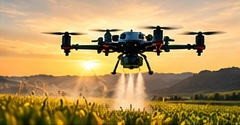
Treatment Planning
Prescription zones, spraying missions, fertilizer strategy and post-treatment verification.
Know Every Block. Act Where It Matters.
What is happening in the vineyard? What should you do about it? Will better field intelligence save time, inputs or crop loss? RAVAM combines drones, agricultural rovers, mobile field infrastructure and AI around those three questions.
 DRONES ABOVE · ROVERS IN THE ROWS · INTELLIGENCE EVERYWHERE
Regional intelligence outside. Parcel intelligence inside.
We should keep the full interactive map and calculator as a dedicated working tool, while the RAVAM AGRO page explains where it fits within the larger operating system.

Screen the regional agronomic context before going to the parcel.
Explore country and district-level agricultural screening across the Balkans and Southeast Europe, including dominant agronomic questions and regional fertilizer considerations.
OPEN INTERACTIVE MAP →
Turn field inputs into a structured nutrient calculation.
The integrated working model includes an advanced nutrient-budget calculator. Its output is planning support—not a substitute for parcel soil analysis, crop stage, yield target and agronomic validation.
OPEN CALCULATOR →Analyze First. Apply Second.
The value of autonomy increases when sensing and treatment operate inside the same data loop.
Third-party products or mission-specific formulations can be applied according to the agronomic plan.
RAVAM AGRO can support targeted spraying and fertilizer workflows, but the prescription should remain grounded in soil analysis, crop requirements, product instructions and local agronomic practice.

Built Around the Farm, Not One Device.
The system can be configured for open fields, orchards, vineyards and other managed agricultural environments.


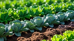


The goal is not another farm dashboard. It is an agricultural intelligence loop that can observe, decide, execute and learn.
Regional maps, parcel data, autonomous missions and treatment history can progressively form a richer agricultural intelligence layer over time.

Build an Agricultural Intelligence System.
From one farm or vineyard to larger regional agricultural operations.